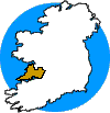
 The
Burren is one of the most famous and unique geological sites in Western
Europe. It is a compact upland area of Carboniferous limestones, with remnant
caps of Namurian shales forming isolated peaks (Slieve Elva and Poulacapple)
in the western part of the area.
Around the shale peaks the caves are typically canyon passages with sinks developed at the shale/limestone boundary.
The longest cave in Ireland, Poulnagollum/Poll Elva, is situated on the eastern edge of Slieve Elva. In the area known as the High Burren, further east, the shale cover has been completely removed. Here the karst scenery is at its most spectacular. Large closed depressions exist and caves are known at Kilcorney, Carran and Caherconnell.
>Guidebooks
>Accommodation
The most recent work on the caves in the area is "The Caves of County Clare" by C. A. Self, published by the University of Bristol Speleological Society (UBSS, 1981). This is an update of an earlier book "The Caves of North West Clare" by E. K. Tratman and also published by UBSS.
Other information on the area can be found in various copies of Irish Speleology and "The Proceedings of the University of Bristol Speleological Society".
Accommodation is plentiful in the area as it is a popular tourist region. There are independent hostels and "Rent an Irish Cottage" schemes. Details from Bord Failte, Head Office, Baggot Street Bridge, Dublin 2.
Pubs are plentiful and widespread but Hylands Hotel in Ballyvaughan, P. J. O'Donoghues in Fanore, the Roadside Tavern in Lisdoonvarna and McGann's and O'Connor's in Doolin are the most regularly frequented by cavers.